WTC uses extensively experienced, knowledgeable teams and cutting-edge equipment to deliver accurate surveying and mapping projects in the most demanding work environments while prioritizing efficiency and safety. WTC understands that timely, accurate and usable information is crucial for client decision-making in the fast-paced business climate in which we work.
As a full-service consulting, engineering, surveying, construction and technical services firm, we have a surveying team specializing in professional land surveying, construction services, geographic information system (GIS) mapping and LiDAR/3D scanning services. Markets we serve include oil and gas, power, transportation, water and wastewater.
WTC utilizes the latest equipment and software to deliver the greatest efficiency and accuracy to our clients. WTC maintains a commitment to safety and quality work. Whether surveying hundreds of well locations or hundreds of miles of pipeline or performing an as-built survey of an existing plant facility, our survey team is ready to complete your project.
EXPERT LAND SURVEYORS NEAR YOU
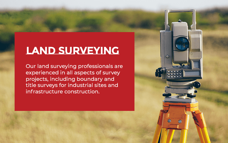
Our land surveying professionals are experienced in all aspects of survey projects, including boundary and title surveys for industrial sites and infrastructure construction, as well as pipeline surveying and well-staking services. If your company needs to plan new wells, we can help find suitable sites and assist with grading, cut and fill requirements, utilities and access roads. If your company needs to build a new pipeline or establish boundaries for new sites or utilities, our team can assist with mapping, establishing right-of-way and planning wells, before and after topographical surveys, lines and easements.
With pipeline surveying, we can assist with numerous challenges associated with surveying, routing and development. Below are a few of the advantages of professional surveying in pipeline development:
- Routing efficiently: When you build a new pipeline, you need to know it will follow the most efficient route. Despite a surge in renewable energy, oil and natural gas consumption still account for about 69% of United States energy consumption, and pipelines send these critical fuels to the consumers who need them. We use the latest technology, such as GIS mapping, to help you identify terrain changes, canyons and other geographic challenges. Armed with this information, you can construct a sound, efficient pipeline that helps you meet your delivery goals.
- Identifying legal obstacles: The proposed pipeline path may run through land that presents challenges to legal ownership. These obstacles become particularly thorny when different people own the surface estate and mineral estate, as they may in Texas. Our experienced survey team has the skills and experience necessary to research ownership through right-of-way contracts, easements, state and federal land statutes and other documents and smooth your path to completion.
- Detecting potential environmental hazards: The proposed pipeline may present ecological concerns, particularly if its route cuts through sensitive areas like wetlands. Our surveying team can identify potential environmental risks and help your company avoid or minimize them.
- Ensuring safety: At WTC, our land surveying and mapping solutions come with a commitment to the highest safety levels. Because safety is one of our highest priorities, you’ll know you’re engaging in ethical practices by ensuring worker protection.
Below are some other land surveying services we offer:
- Oil, Gas, Water and Injection Well Staking and Platting.
- Lease Boundary and As-Built Surveying and Mapping
- Electrical and Support Utilities.
- Transmission Line Staking and Easement Platting.
- Distribution Line Staking and Easement Platting.
- Substation Boundary Staking and Platting.
- Gas Gathering, Flowlines, Oil Gathering, Midstream, Injection Pipeline Staking and Easement Platting.
- Facilities Design, Staking and Platting.
- Roads, Pads, Pits and Tanks.
- Archeological Boundary Surveys.
- Residential Property Survey to Build a House On.
CIVIL SITE DEVELOPMENT
In civil site development, you need a reliable partner that can help you plan, model and design the site and secure the certifications and permits necessary to build. Whether you need to develop a cohesive subdivision, plan skyscrapers that meet zoning requirements, survey land to replot it into two plots or determine how and where to build in a flood zone, you’ll also need reliable data that gives you a secure basis for proceeding. Our team has the industry knowledge and experience to assist with processes like the following:
- The American Land Title Association/The American Congress on Surveying and Mapping (ALTA/ACSM) Title Surveys.
- Boundary Surveys.
- Federal Aviation Administration (FAA) Certificates.
- Subdivision Planning and Design Services.
- Flood Zone Certifications and Planning.
- Civil Site Design.
Partner With WTC for Texas Land Surveying
To gain dependable professional assistance with land surveying and civil site development for your next project, work with WTC.
We’ve been working in the Permian Basin for over seven decades, so we are highly experienced with the ins and outs of property surveying near you within the Permian Basin. Our long-standing relationships with oil and gas companies and municipalities in the region have given us keen insight into providing efficient, accurate deliverables to enhance your productivity. Whether you need surveying in Andrews, Lubbock, Odessa, Midland or beyond, we have the resources and expertise to give you fast, fair and reliable services.
Fill out our online contact form to hear from a member of our team or begin your surveying project.
WTC utilizes the latest equipment and software to deliver the greatest efficiency and accuracy to our clients. WTC maintains a commitment to safety and quality work, whether surveying hundreds of well locations, hundreds of miles of pipeline, determining if your site is viable for development or performing an as-built survey of an existing plant facility, our survey team is ready to complete your project.